Brief Description
The province has an area of 1,372.98 square kilometres (530.11 sq mi), and covers the entire Bataan Peninsula, a rocky extension of the Zambales Mountains jutting out into the South China Sea, enclosing the Manila Bay. At the northern portion of the peninsula is Mount Natib (elevation 1,253 metres (4,111 ft)) and its surrounding mountains, separated from Mount Samat and the Mariveles Mountains in the south by a pass.
History

16th century
Classical Period
The first inhabitants of the Bataan peninsula are the Ayta Magbeken people, who are one of the first Negrito ancestors of present-day Filipinos. Later on, Tagalog communities from southern Luzon migrated to parts of Bataan and the Ayta Magbeken migrated towards the mountain areas of Bataan by the end of the 16th century.
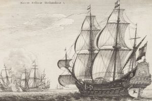
1647
Colonial Period
In 1647, Dutch naval forces landed in country in an attempt to seize the islands from Spain. The Dutch massacred the people of Abucay in Bataan. Historian Cornelio Bascara documents that the province of Bataan was established on January 11, 1757 by Governor-General Pedro Manuel Arandia out of territories belonging to Pampanga and the corregimiento of Mariveles which, at that time, included Maragondon, Cavite across the Manila Bay.
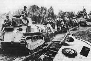
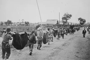
7 January – 9 April 1942
Battle of Bataan
The Battle of Bataan was fought by the United States and the Philippine Commonwealth against Japan during World War II. The battle represented the most intense phase of the Japanese invasion of the Philippines during World War II. In January 1942, forces of the Imperial Japanese Army and Navy invaded Luzon along with several islands in the Philippine Archipelago after the bombing of the American naval base at Pearl Harbor.
Mission
Excellent public service that encourages multi-sectoral engagement.
Vision
By 2030, Bataan will achieve quality growth driven by diversified economic investments and efficient governance resulting in STABLE and empowered families.Excellent public service that encourages multi-sectoral engagement.
